Photos | Navigating the Skies with Precision
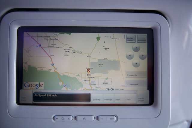
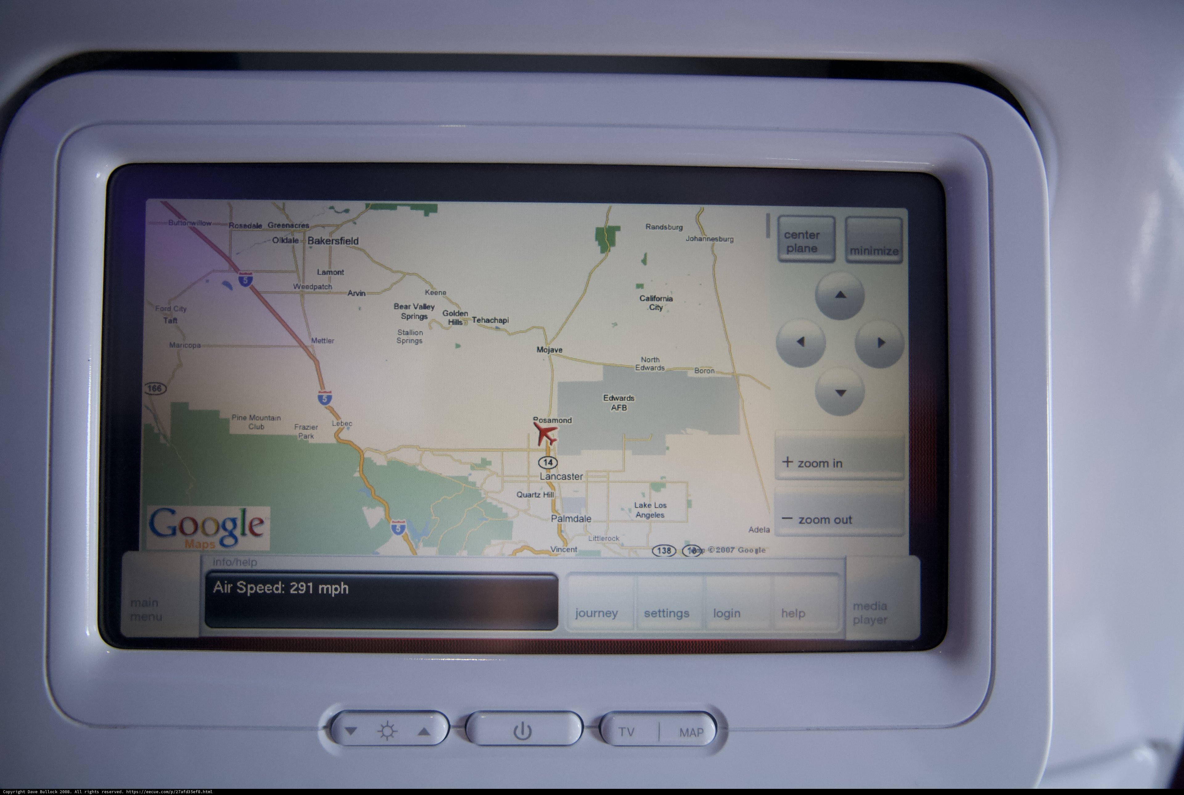
A high-tech map on a plane monitors the flight path with GPS technology and computer hardware. As we soar through the clouds, we can rely on these electronics to guide us smoothly to our destination.
BLIP-2 Description:
a map on a plane with google mapsChronologically Adjacent

Note: You can also navigate with your arrow keys or swiping.
Metadata
Capture date:
Original Dimensions:
4368w x 2912h - (download 4k)
Usage
Dominant Color:
north mettler white pine quartz mountain palmdale bakersfield randsburg white_knight_two rosadale littlerock gps vincent tehachapi air info main mane stallion two mojave greenacres tv settings city speed document hardware google minimize frazier valley lake help journey login electronics edwards zoom adela ford boron media knight mph plane los lamont bear center posamond springs мар screen player machine angeles map hills arvin monitor computer lancaster hill california
Detected Text
2007 291 air angeles adela arvin boron bakersfield city california center edwards ford frazier google greenacres hill help hills info lancaster los lake lamont littlerock login main mane media mettler mojave mph mountain pine plane palmdale player posamond quartz randsburg rosadale springs settings speed stallion tv tehachapi valley vincent bear in journey minimize north out zoom мар
iso
1600
metering mode
5
aperture
f/2.8
focal length
24mm
shutter speed
1/400s
camera make
Canon
camera model
lens model
overall
(28.59%)
curation
(25.00%)
highlight visibility
(1.99%)
behavioral
(10.09%)
failure
(-0.29%)
harmonious color
(2.55%)
immersiveness
(0.15%)
interaction
(1.00%)
interesting subject
(-76.17%)
intrusive object presence
(-5.20%)
lively color
(-2.94%)
low light
(1.22%)
noise
(-0.56%)
pleasant camera tilt
(-8.26%)
pleasant composition
(1.16%)
pleasant lighting
(-9.10%)
pleasant pattern
(3.30%)
pleasant perspective
(11.64%)
pleasant post processing
(6.63%)
pleasant reflection
(-9.82%)
pleasant symmetry
(5.27%)
sharply focused subject
(4.86%)
tastefully blurred
(1.77%)
well chosen subject
(14.09%)
well framed subject
(59.62%)
well timed shot
(-7.26%)
all
(3.19%)
* WARNING: The title and caption of this image were generated by an AI LLM (gpt-3.5-turbo-0301
from
OpenAI)
based on a
BLIP-2 image-to-text labeling, tags,
location,
people
and album metadata from the image and are
potentially inaccurate, often hilariously so. If you'd like me to adjust anything,
just reach out.